Advanced Hazus Analysis. Using FEMA’s Risk Assessment Software to its Maximum Capabilities.
How Can We Help?
-

Inventory Update
Can I use my local data in Hazus? What attributes does my GIS need for Hazus? Where do I find foundation type and first floor height? What additional data will I need to collect?
Whether your community or organization is updating a Hazus Mitigation Plan or just running a risk assessment, Community Resilience Consulting can help integrate your data into Hazus efficiently. We understand which attributes are required and where you can find the data.
-

Hazard Identification
How do I convert a FEMA floodplain into a flood depth grid for Hazus import? Can I model sea-level rise in Hazus? How do I run an average annualized loss in Hazus?
Community Resilience Consulting has decades of experience running Hazus including supporting FEMA Headquarters with software testing. We can run the flood model inside Hazus or import a flood depth grid from another source.
-
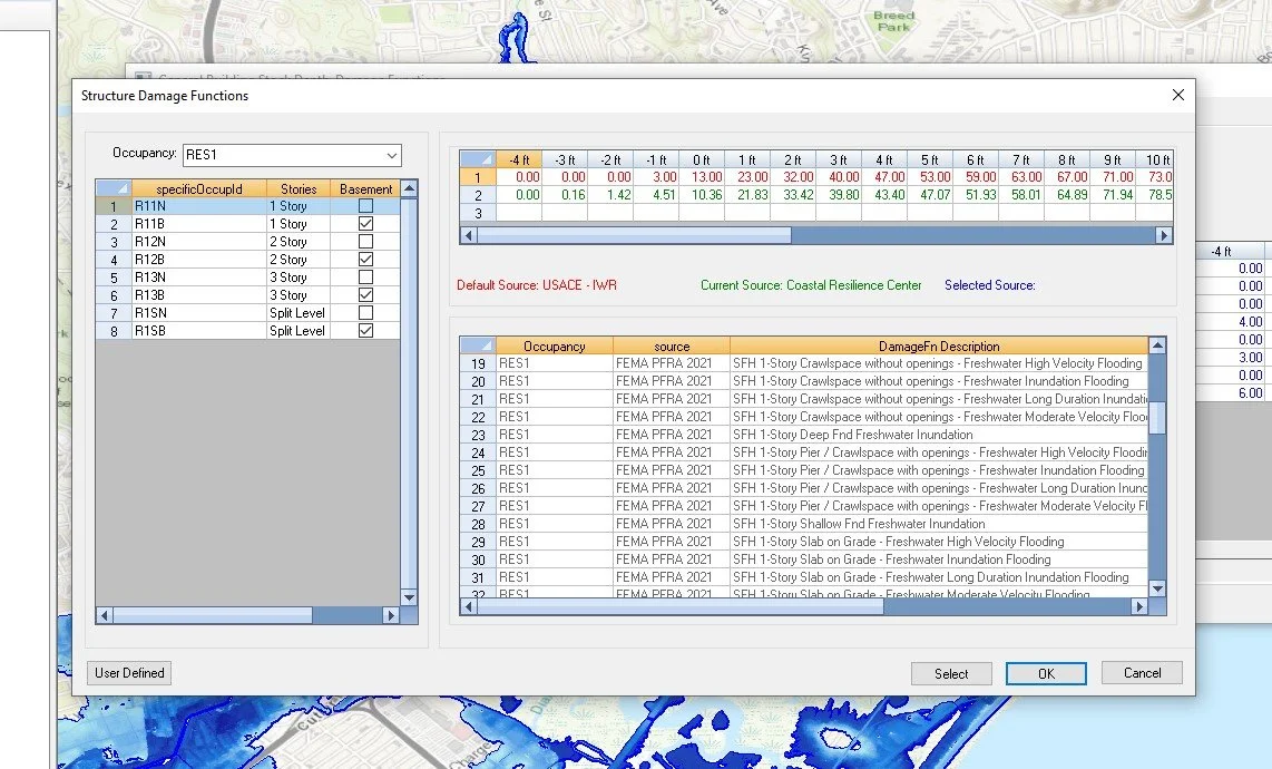
Advanced Application
Does this damage function make sense for my community? How do I model a long duration flood? I don’t think the U.S. Census accurately captures my tribal community, can I update the data? Can I model mitigation before implementation?
Hazus has many capabilities, but it is a complex software to run. Our Hazus experts understand how each component of the software works and can support earthquake, flood, hurricane, and tsunami advanced applications.